Introduction
To answer that question we turned to Open Charge Map (2024), first reviewing its charge point data against other sources & updating it as necessary (note that Open Charge Map data excludes private home chargers, while access restrictions may be present at locations). Data was then downloaded for Ireland, & a number of conditions applied to the charge point data being counted:
- Site must be Operational;
- Connector(s) must be Operational, &;
- CCS, Chademo, & Type 2 (encompasses both Tethered & Untethered) only.
Counties were determined by the geographic coordinates of the charge points & cross-referenced with county boundaries (Department of Public Expenditure NDP Delivery & Reform, 2024).
Results
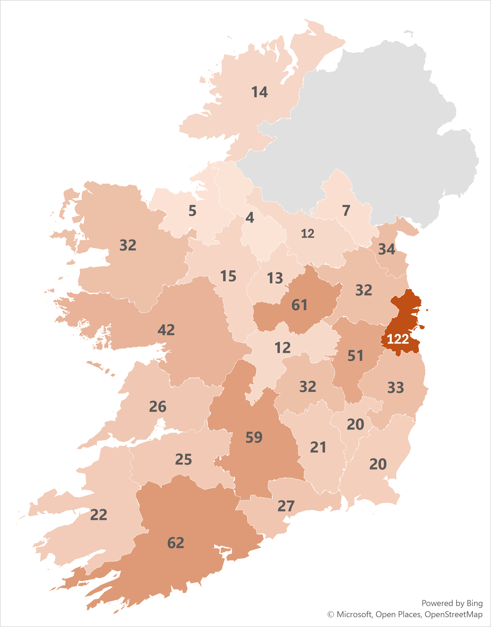
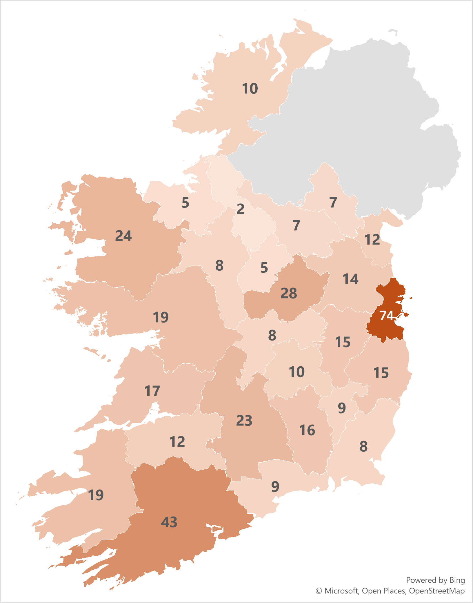
Presented below are three figures, separately providing the number of CCS, Chademo, & Type 2 connectors per county, as at 5 October 2024.
Figure 1: Number of CCS connectors per county

Figure 2: Number of Chademo connectors per county

Figure 3: Number of Type 2 connectors per county

In summary, for Ireland as at 5 October 2024 there are:
- 803 CCS connectors;
- 419 Chademo connectors, &;
- 4,437 Type 2 connectors.
Future Updates
We hope to update these statistics on a recurring basis, & add additional insights.
Numbers of Home Chargers
While no data source exists for this information, SEAI publish details of the number of home charger grants issued (SEAI, 2024).
References
Department of Public Expenditure NDP Delivery & Reform (2024). Counties - National Statutory Boundaries - 2019 - Dataset - data.gov.ie. Available at: https://data.gov.ie/dataset/counties-national-statutory-boundaries-20191 (Accessed: 5 October 2024).
Open Charge Map (2024) Open Charge Map - The global public registry of electric vehicle charging locations. Available at: https://www.openchargemap.org (Accessed: 5 October 2024).
SEAI (2024) Local Authority Climate Action Plan Dashboard. Available at: https://www.seai.ie/data-and-insights/seai-statistics/la-cap-dashboard (Accessed: 5 October 2024).